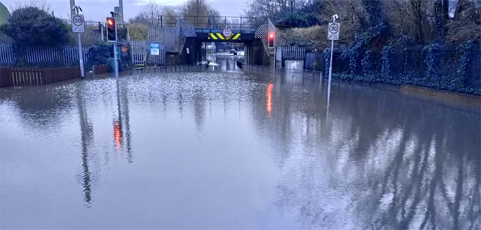
Warrington knows what high water looks like. The council’s own investigation into Storm Christoph found that around 438 properties flooded internally in January 2021, with a further 605 flooded externally.
Brook levels rose by 1.5 to 2 metres above normal winter levels, and several gauges broke all-time records. Then in September 2025, the evacuations in Dallam put an estimated 180 properties at risk overnight.
Photo by Chris Gallagher on Unsplash
Alt text: Floodwater from a swollen river surrounding stone houses and a submerged car in a northern English town
Planning an extension, a new home or a change of use near the Mersey or Sankey Brook? Flood risk will come up. In Flood Zone 2 or 3, the council expects a planning flood risk assessment report with the application, not after it. Knowing this early saves weeks.
How Do You Check Which Flood Zone Your Property Is In?
Start with the Environment Agency’s Flood Map for Planning on gov.uk. Enter your postcode, draw your site boundary and it shows your flood zone. It also says whether an assessment is likely to be needed.
The zones describe the chance of flooding from rivers or the sea each year. Flood Zone 1 has less than a 1 in 1,000 annual chance from rivers. Flood Zone 2 sits between 1 in 100 and 1 in 1,000 from rivers. Flood Zone 3 carries a 1 in 100 or greater chance from rivers, or 1 in 200 or greater from the sea.
Warrington has both kinds of risk. The Mersey is tidal through the town, and the Environment Agency issues tidal warnings for areas such as Knutsford Road and Bank Quay. Sankey Brook, Dallam Brook and Longford Brook add river risk on the west and north sides of town.
Surface water matters too. The long term flood risk service shows the chance of flooding from heavy rain at your address. Liverpool Road at Sankey Bridges has flooded repeatedly since the 1960s. That history led to the new Liverpool Road drainage scheme with a pumping station.
When Will Warrington Borough Council Ask for an FRA?
National guidance and Warrington’s Local Plan set the triggers. You will usually need an assessment for:
- Development in Flood Zone 2 or 3, including minor extensions and changes of use.
- A site of 1 hectare or more, even in Flood Zone 1.
- A Flood Zone 1 site the flood map shows at risk from surface water, now or in future.
- Land in an area with critical drainage problems.
- A change of use to a more vulnerable use, such as a shop becoming a flat, on land exposed to other flood sources.
The council is also the Lead Local Flood Authority for the borough. Its engineers review applications for drainage impacts. Its flood risk pages hold the local strategy and past investigation reports. Local Plan policy ENV2 says the council will only support proposals where flood risk has been fully assessed and justified. If in doubt, ask at the pre-application stage.
What Does a Householder or Minor Development FRA Cover?
Most homeowners fall under the Environment Agency’s standing advice for minor extensions. This covers householder and non-domestic extensions up to 250 square metres.
The standing advice recommends floor levels at least 600mm above the estimated flood level. This can drop to 300mm where the flood level is known with high certainty. If you cannot raise the floor, you should add resistance measures up to 600mm above the flood level instead.
| Report element | What it shows the planning officer |
| Site address and description | Exactly what is being built and where |
| Estimated flood level | Expected water level, including climate change |
| Finished floor levels | How the new floor compares with that level |
| Resistance and resilience plan | How water is kept out and how the home recovers |
| Plans and drawings | That the design matches the report |
A change of use needs more. The report must look at flooding from all sources, residual risk if defences fail and a safe route out during a flood.
Costs are often lower than people expect. Rida Reports lists a fixed £750 fee for extensions and changes of use under 250 square metres. A single new dwelling is £800. Its initial reports are ready for validation within 48 hours. Detailed Environment Agency modelling data can take around 21 working days, so request it early if your site needs it.
Which Resilience Measures Work for Warrington Homes?
Resistance keeps water out. Resilience limits the damage when it gets in. Good designs use both.
- Fit flood doors or demountable barriers to openings up to 600mm above the flood level.
- Add non-return valves to drains so sewage cannot back up into the house.
- Raise sockets, boilers and consumer units above the expected water level.
- Use lime plaster, tiled floors and solid timber or plastic kitchen units downstairs.
- Lay permeable paving on new drives so rain soaks in rather than running off.
Photo by David Walker on Unsplash
Alt text: A red brick house with its front door set at pavement level
Under the Flood Re Build Back Better scheme, households can access up to £10,000 to add resilience when repairing flood damage. Meanwhile, the Sankey Brook Flood Risk Management Scheme has £2.465 million allocated for 2026/27, with ground investigations starting this autumn.
What Should You Do Before Submitting Your Plans?
Work through these steps before you pay the planning fee:
- Check your flood zone and surface water risk online and save the results.
- Ask your architect to show existing and proposed floor levels on the drawings.
- Commission the flood risk assessment alongside the design, not after it.
- Build any resistance measures into the drawings so the report and plans match.
- Submit the assessment, drawings and drainage details together.
Frequently Asked Questions
Can a Flood Zone 1 Site Still Need an Assessment?
Yes. A site of 1 hectare or more always needs one. So does a site at risk from surface water or with critical drainage problems. Check both the flood map for planning and the surface water map before assuming you are clear.
Is Surface Water Flooding Covered by the Assessment?
A proportionate report should consider flooding from rivers, the sea, surface water, groundwater and reservoirs. Your assessor should show the design will not push water onto neighbours.
How Long Does the Process Take Before I Submit?
A simple householder report can be ready within a few days. Sites needing detailed Environment Agency data may wait several weeks for that information. Start early so the report does not hold up your submission.
Who Should Prepare a Householder Flood Risk Assessment?
Use a qualified flood risk consultant, ideally a chartered engineer with planning experience. The council needs evidence it can rely on, not a generic template. A good assessor will also work with your architect on floor levels.
Living Alongside the Brook
Building near water in Warrington is not off limits. It needs honest evidence and a design that expects the odd flood. Check your zone, talk to the council early and get the assessment done alongside your drawings.